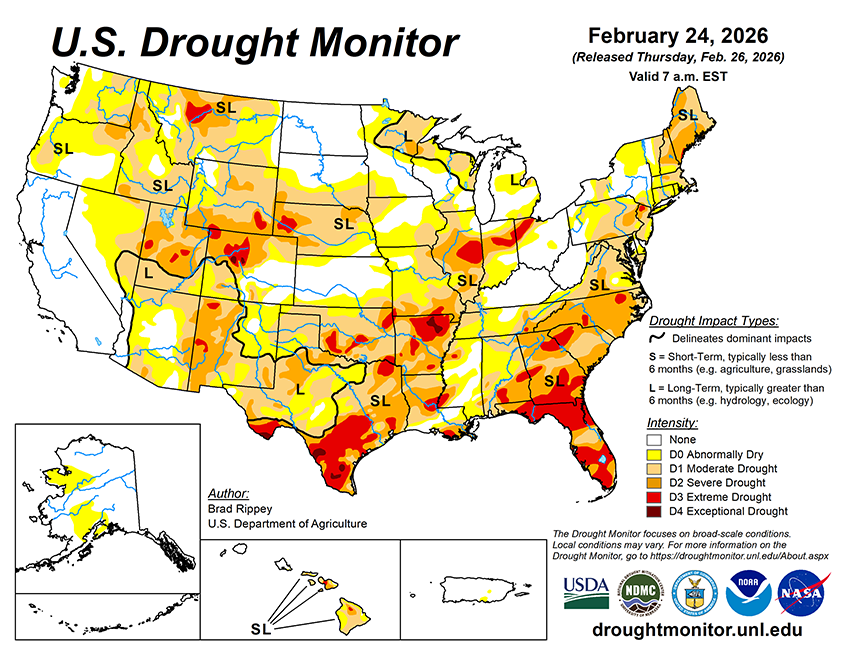
Fast-moving, loosely organized disturbances will traverse the country during the next 5 days. Some of the heaviest precipitation, locally 1 to 2 inches or more, should fall in the Southeast, mainly through Friday. Beneficial showers will linger into the weekend across Florida’s peninsula. In contrast, dry weather will prevail during the next 5 days in the nation’s southwestern quadrant, from southern California to the central and southern High Plains. Record-setting warmth will accompany the dry weather, with temperatures routinely topping 90°F in southern Texas and the Desert Southwest. Farther north, a new plume of Pacific moisture will arrive on Saturday across southern Oregon and northern California. That moisture will race eastward, sparking wintry precipitation by Sunday and Monday from the central Plains into the mid-Atlantic, including the Ohio Valley and neighboring regions.
The NWS 6- to 10-day outlook for March 3 – 7 calls for the likelihood of warmer-than-normal weather nationwide, except for near- or below-normal temperatures in parts of New York and much of New England. Meanwhile, near- or above-normal precipitation across most of the country should contrast with drier-than-normal conditions in coastal North Carolina and portions of the Far West, including California and the western Great Basin.