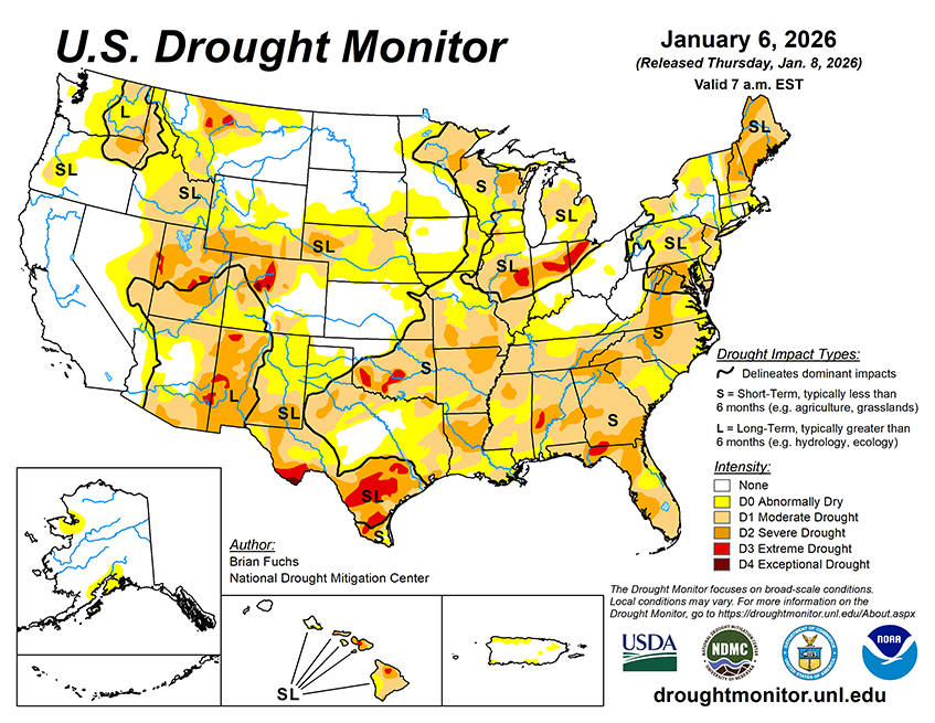
Over the next five to seven days, much of the western half of the U.S. is anticipated to be dry from the West into the Plains. The wettest areas are anticipated to be over the Great Lakes region and into the Northeast. At the end of the period, there could be some coastal precipitation in portions of south and east Texas as well as Louisiana. Temperatures during this time are anticipated to well above normal over the West, with departures of 10-13°F above normal from Nevada into Utah and Wyoming. Cooler-than-normal temperatures will be commonplace over the eastern half of the country, with the greatest departures over the upper Midwest and Great Lakes with departures of 10-13°F normal. The below-normal temperatures will migrate all the way into the South, with portions of the Southeast and Florida 6-9°F below normal.
The 6-10 day outlooks show that the likelihood of above-normal temperatures over much of the Southwest and southern Plains. The best chances of below-normal temperatures will be over the upper Midwest and into the Northeast. From the northern Plains into the Southeast and Florida and areas east of here have the best chances of below normal temperatures. Precipitation is expected to be below normal over Florida and the coastal areas of the Pacific Northwest. The best chances of above-normal precipitation are anticipated over the Tennessee Valley as well as over the Rocky Mountains and into the Southwest.


