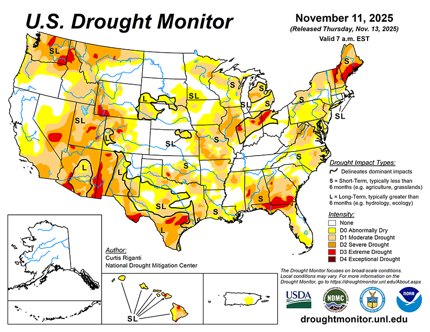
From the evening of Nov. 12 through Nov. 17, the National Weather Service (NWS) Weather Prediction Center is forecasting heavy precipitation to fall across parts of the western U.S. Precipitation amounts from 3-5 inches (locally higher) may fall across large portions of California, especially the southwest coastal areas and portions of the Sierra Nevada. Heavy precipitation amounts from 2-5 inches (locally higher) are also anticipated in parts of northwest Washington and the Olympic Peninsula. Over 0.75 inches of precipitation is also forecast in southeast California, southern Nevada, portions of western and central Arizona and southwest Utah. A few other locales may receive an inch or more of precipitation, including the San Juan Mountains in southwest Colorado and parts of the northern Idaho Panhandle and northwest Montana. Much drier weather is forecast across most of the rest of the Contiguous U.S. for this period, though some parts of New York and New England may receive over a half inch of precipitation.
For the period from Nov. 18-22, the NWS Climate Prediction Center forecast favors above-normal precipitation across much of the Contiguous U.S., especially from the Southwest northeastward to the Lower Ohio River Valley. Drier-than-normal weather is slightly favored in northeast parts of Maine, while near-normal precipitation amounts are most likely in the Florida Peninsula. Near-normal temperatures are favored for New England, while elsewhere, colder-than-normal temperatures are likelier west of the Continental Divide, while warmer-than-normal temperatures are favored to the east of the Continental Divide. Forecaster confidence in warmer-than-normal weather is highest from the Gulf Coast north to the Lower Midwest and southern Great Plains, and near and west of Lake Superior. Above-normal precipitation and temperatures are favored in Hawaii. In Alaska, above-normal precipitation is also favored, with the strongest chances being in the southwest part of the state. Above-normal temperatures are favored in most areas of Alaska, except for the far northwest, where near-normal temperatures are expected.


