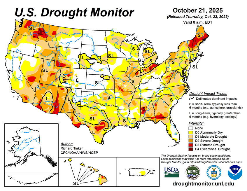
Over the next 5 to 7 days, two general areas are expected to receive heavy precipitation: The Pacific Northwest, and a swath from the southern Great Plains through the Lower Mississippi and Lower Ohio Valleys. Windward areas and higher elevations are expecting 5 to locally over 10 inches of precipitation, with 2 or more inches anticipated for other areas from the Cascades to the Pacific Coast. Meanwhile, 3 to 5 inches are expected from the Red River (South) Valley into eastern Texas and parts of the Lower Mississippi Valley. Elsewhere, totals exceeding 1.5 inches are forecast in the higher elevations of northern and central Idaho and adjacent areas. Moderate amounts (0.5 to locally over 1.5 inches) are expected to fall on the Ohio Valley, the Middle and Upper Mississippi Valley, and remaining locations in the southern half of the Plains outside Deep South Texas. Look for a few tenths to around an inch of precipitation in the northern Sierra Nevada, plus portions of the northern Intermountain West and Rockies. Elsewhere, light amounts at best are anticipated in most of New England, parts of the Mid-Atlantic region, the South Atlantic coastal plain, much of Peninsular Florida, Deep South Texas, most lower elevations across the interior West including the Southwest into central California, plus most of the Great Basin. Daily highs are forecast to average 4 to 8 deg. F below normal from central California through the Pacific Northwest and across the northern Intermountain West. Similar anomalies should affect the Atlantic Seaboard and Piedmont from northern Georgia through southern New England. Meanwhile, unusually warm weather will likely continue across the northern Plains, with daily highs averaging 5 to 10 deg. F above normal from northern Minnesota through the Dakotas and northern Great Lakes into northeastern New York. Also, highs averaging 4 to 8 deg. F above normal are expected from the Southwest through western and southern Texas. Low temperatures should average warmer with respect to normal across most of the Lower-48, especially over the Plains, Mississippi Valley, the Southwest, and the Great Basin. Low temperatures could average 6 to 13 deg. F above normal in the northeastern Great Plains and adjacent areas. The only broad area expecting below-normal lows (by 2 to 5 deg. F on average) stretches from Virginia northward through much of New York.
The 6-10 day outlook valid for October 29 – November 1 favors heavier than normal precipitation continuing across the Pacific Northwest, where odds for significantly above-normal precipitation range from 50 to 70 percent. Wet weather is slightly favored across most of the Rockies and Plains as well as parts of central and northern California, northwestern Nevada, and the Pacific Northwest. Wetter than normal conditions are nominally favored across Hawaii. Abnormally dry weather is expected from central and western Texas through central and southern sections of the High Plains and Rockies. Odds for subnormal amounts exceed 50 percent from eastern Arizona through parts of the Texas Big Bend. Meanwhile, warm weather is favored from California, the Southwest, and the Great Basin through parts of the northern Rockies, the High Plains, the northern Great Plains, the Great Lakes, and northern New England. There is a better than 60 percent chance for warmth from southern California into western New Mexico. Cool weather is forecast across the South Atlantic region from Maryland through parts of Florida along with the central and southern Appalachians and the adjacent central Gulf Coast. The Hawaii forecast favors warmth, with chances exceeding 50 percent across the western half of the island chain.


