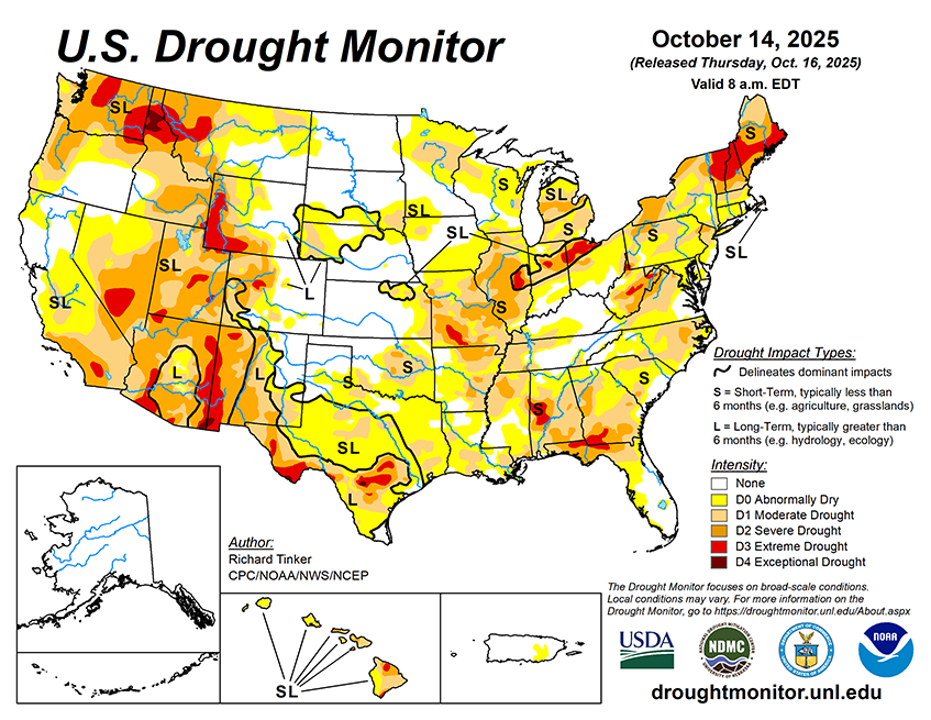
During October 15-20, 2025, heavy precipitation (1.5 to 3.0 inches) is forecast for coastal and windward locations from the Cascades to the Pacific Ocean, across eastern Montana and adjacent North Dakota, along a frontal boundary from the Middle Mississippi Valley through the central tier of the Great Lakes Region, and across scattered locations in northwestern Pennsylvania, the Tennessee Valley, and the Lower Ohio Valley. Moderate amounts of 0.7 to 1.5 inches are anticipated in the remainder of the Pacific Northwest, the higher elevations of the northern Intermountain West, central and northern Wyoming, the northern tier of the Plains, parts of the central Great Plains, most areas from the southeastern Great Plains through the Gulf Coast Region, the interior Deep South, most of the Ohio Valley, the lower Northeast, and southern New England. Meanwhile, a few tenths of an inch at most are expected across the South Atlantic Region, most of the southern half of the Plains, and the southwestern quarter of the Lower-48. Temperatures should average generally below-normal from the Rockies westward, and above-normal from the Plains to the Atlantic Coast. Daily highs are expected to average 4 to 5 deg. F below normal from southeastern California through southern Idaho and eastern Oregon while readings top out 8 to 11 deg. F above normal on average across central and southern Texas and most of Maine.
The 6-10 day outlook valid for October 21-25 favors heavier than normal precipitation across central and northern California, northwestern Nevada, and the Pacific Northwest. Chances for totals in the top one-third of historical occurrences exceed 60 percent west of the Cascades. Wetter than normal conditions are nominally favored across Hawaii, most of Alaska, southern sections of the Rockies and High Plains, central and western Texas, and from the Great Lakes through much of the mid-Atlantic Region and Northeast. Subnormal precipitation is more likely across central and northern sections of the Rockies and Great Plains as well as parts of the South Atlantic Region. Warmer than normal weather is expected from the northern Intermountain West to the Appalachians, plus much of the South Atlantic and Northeast. Southern Texas and most of Maine are most likely to experience warmer than normal weather. Unusually warm weather is also favored across the eastern half of Mainland Alaska and across Hawaii. Temperatures are expected to average closer to normal from the Rockies through the West Coast and across the Carolinas and Virginias. The central tier of Alaska is also expected to average near normal while subnormal temperatures are nominally favored across western Mainland Alaska.


