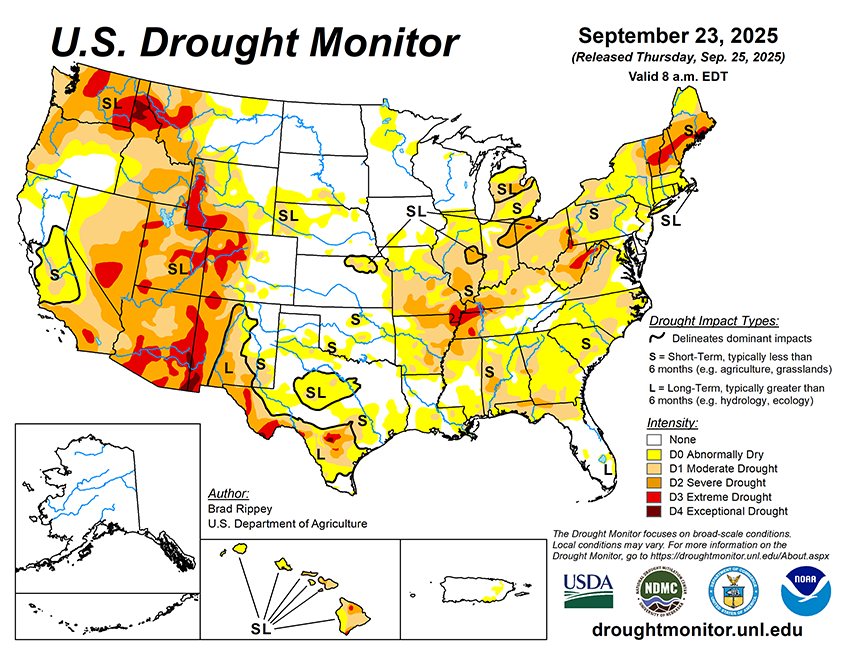
Rainfall will continue to shift southward and eastward, resulting in a boost in soil moisture in many areas experiencing short-term drought. Five-day rainfall should reach 1 to 3 inches or more across much of the eastern U.S., as well as portions of the Gulf Coast States. Once rain ends across the Plains and Midwest, dry weather will prevail for the next several days. Dry weather should extend into the Northwest until late in the weekend, when showers will arrive along the northern Pacific Coast. Elsewhere, a late-season monsoon surge will result in unusually heavy showers for this time of year in parts of the Southwest, leading to another round of possible flash flooding.
The NWS 6- to 10-day outlook for September 30 – October 4 calls for near- or above-normal temperatures nationwide, with the north-central U.S. having the greatest likelihood of experiencing warmer-than-normal weather. Meanwhile, near- or above-normal precipitation across most of the country should contrast with drier-than-normal weather in a band stretching from the southern Plains into the Great Lakes region and the Northeast.