National Current Conditions... July 9th thru July 15th

The trend continues with drought worsening in the West (especially the Northwest) and improving in the East. The Midwest and Plains saw a mix of improvements and degradations (although the Plains saw large areas improve).
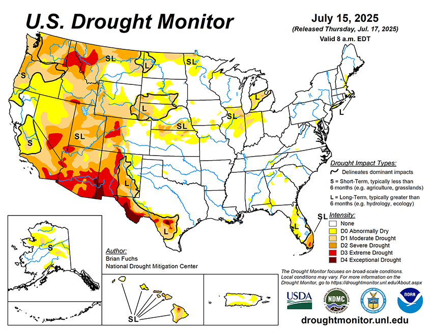
As of July 15, 2025, 26.65% of the U.S. and Puerto Rico and 31.41% of the lower 48 states are in drought, according to the U.S. Drought Monitor.

This Week's Drought Summary…
The last seven days was highlighted by dryness over much of the West, a continued active pattern bringing substantial rains to the southern Plains, and a wet week over much of the Mid-Atlantic and portions of the Midwest. Texas again stood out with several rain events that brought with them localized flooding. The long-term drought signal is still holding on in portions of southern Texas as recharge to depleted water systems has been slow, even with the rain in the region. Above-normal precipitation was recorded from eastern Nebraska through Illinois, bringing some much-needed rain to parts of northern Illinois. With the active rain pattern, temperatures over the southern Plains were 2-4 degrees below normal from Texas to Kansas and Nebraska while much of the West was 4-6 degrees above normal, with the greatest departures in Arizona and the Pacific Northwest. Warmer-than-normal temperatures dominated much of the eastern portions of the Midwest and the Northeast, where temperatures were 6-8 degrees above normal.


