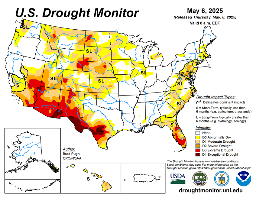
A cut-off low pressure system is forecast to bring widespread, heavy precipitation to the Southeast with the Weather Prediction Center depicting more than 3 inches of precipitation for southeastern Alabama, central to south Georgia, and the Florida Panhandle through May 12. Following a wet week, another round of precipitation (1 to 2 inches) is expected from northern New Jersey northward to New England on May 9 and 10. Elsewhere, mostly dry weather is forecast for the Corn Belt along with much of the Great Plains and West. The dry weather will be accompanied by unseasonably warm temperatures across the Northern Great Plains. By May 12, precipitation is forecast to overspread the Pacific Northwest as a low pressure system tracks inland from the northeastern Pacific.
The 6-10 day outlook (valid May 13-17, 2025) favors above-normal precipitation for the Mid-Atlantic, Florida Peninsula, Upper Mississippi Valley, Northern to Central Great Plains, and much of the West. Elevated below-normal precipitation probabilities are limited to the Lower Mississippi Valley, western Gulf Coast, and Rio Grande Valley. Above-normal temperatures are likely for most of the eastern and central U.S. with the largest probabilities (more than 80 percent) forecast for the Great Lakes. Below-normal temperatures are favored throughout the West.


