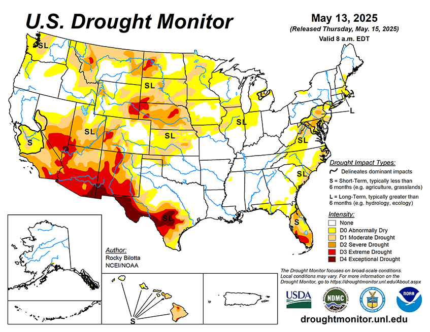
During the next five days (May 13–17, 2025), the slow moving upper low across the Southeast U.S. will be weakening and evolving into an open trough by Thursday as it exits the East Coast. Another upper trough and closed low across the Northern Rockies mid-week will sustain a surface low crossing the Northern Plains and then into south-central Canada by the end of the week, with heavy rain for the Dakotas/Minnesota and late season mountain snow for the northern Rockies. Going into Thursday, the heavier rainfall reaches eastern North Dakota into northern Minnesota, with some of the guidance indicating the potential for 1-2 inch rainfall totals with some embedded convection. Very warm weather will continue across the Upper Midwest for the middle of the week, with highs reaching 85-90 degrees on Wednesday across the eastern Dakotas and much of Minnesota. The anomalous warmth then shifts eastward to the Great Lakes and Ohio Valley regions to close out the week, and much of the East Coast Friday into Saturday ahead of the cold front. Very hot conditions are expected across southern Texas for the entire forecast period with highs exceeding 100 degrees near the Rio Grande, and HeatRisk reaching the major category for these areas. In contrast, chilly conditions are likely for the Intermountain West and Northern Rockies with highs running 5-15 degrees below average with the upper level trough and increased cloud cover.
The 6-10 day outlook (valid May 18–22, 2025) favors above-normal precipitation across most of the U.S., with below-normal precipitation favored in portions of the West Coast states and the Florida Peninsula. Increased probabilities for above-normal temperatures are forecast for Hawaii, from the southern Plains to the Southeast, and in parts of California, Nevada, and southern Alaska.