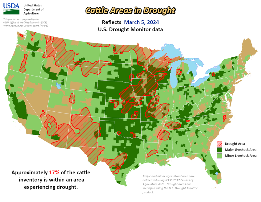
National Current Conditions: February 28, 2024 - March 5, 2024


Heavy precipitation fell across parts of the southern and eastern U.S., and in parts of the West, especially in the Sierra Nevada, where a major blizzard significantly increased snowpack in that range. The Great Plains were mostly dry this week, as were parts of the Midwest, except for rain in parts of Illinois, southeast Wisconsin and Michigan. Recent rainfall improved conditions across much of Puerto Rico. Hawaii has been in a trade wind pattern recently, leading to wet weather on the windward sides of the islands but drier conditions on the leeward sides. Thus, a mix of improvements and degradations occurred there.
Temperatures were near or below normal in much of the western U.S. west of the Continental Divide. In most of the central and eastern U.S., temperatures were near or above normal, especially in the Upper Midwest and Great Lakes, where temperatures from 10 to 15 degrees warmer than normal were common. A few spots in the Great Lakes area checked in even warmer than that, with readings 15-20 degrees above normal.
This Week's Drought Summary…
More warm and dry weather in the Midwest and parts of the Plains led to worsening drought conditions, particularly in Missouri and surrounding states. The West and East saw a few scattered improvements.
As of March 5, 2024, 18.32% of the U.S. and Puerto Rico and 21.84% of the lower 48 states are in drought, according to the U.S. Drought Monitor.
Looking Ahead...
Through the evening of Monday, March 11, the National Weather Service Weather Prediction Center is forecasting widespread precipitation amounts of at least a half inch across much of the central and eastern U.S. (roughly from the Interstate 35 corridor eastward), excluding northern Wisconsin, Minnesota, the Michigan Upper Peninsula, the Florida Peninsula, and central and south Texas. Within this area of precipitation, swaths of at least 1.5 inches of liquid precipitation are forecast from southwest Missouri to southeast Michigan, from southwest Mississippi to central North Carolina, and across most of New England. In the West, mostly drier weather is expected, though some higher precipitation amounts can be expected in the western mountains of northern California, western Oregon and western Washington.
Looking ahead to March 12-16, the National Weather Service Climate Prediction Center forecast favors warmer-than-normal temperatures across the central and eastern U.S., with the highest confidence for warmer-than-normal weather centered around the Upper Midwest and Great Lakes. The forecast favors near- or below-normal temperatures in the Intermountain West, and above-normal temperatures along the West Coast. Above-normal precipitation is favored across large portions of the central and southern U.S., especially in Colorado and New Mexico and the adjacent western Great Plains and in the Deep South and along the Central Gulf Coast. The forecast favors below-normal precipitation along the West Coast. In Alaska, above-normal precipitation is favored in the central and eastern parts of the state, while drier-than-normal weather is favored in the northwest. Colder-than-normal weather is forecast in the central and western portion of Alaska, while southeast Alaska is likely to be warmer than normal. Cooler-than-normal weather is favored in Hawaii along with near-normal precipitation.


